About the Map
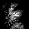
This map was created to show slopes steeper than 30 degrees, where most avalanches occur. It's intended as an aid to help visualise steepness when route planning, alongside other risk factors.
See the SAIS Be Aware Guide for information on how to plan a safe day in the mountains during winter.
The map was prepared using data with a 50 metre resolution, so can only show slopes with a sustained steepness and doesn't include local features in the terrain.
The map layer was created with Open Source data and software.
QGIS
QGIS is a free and open source Geographic Information System, that lets you view and analysis geographic information.
OS Terrain 50
Ordnance Survey Terrain 50 is freely available under the OS Opendata licence. The digital terrain model (DTM) is available as a 50m grid and/or 10m contours.
Ordnance Survey Terrain 50 is freely available under the OS Opendata licence. The digital terrain model (DTM) is available as a 50m grid and/or 10m contours.